My Top Ten Insights from Traveling Route 66

April 24, 2011

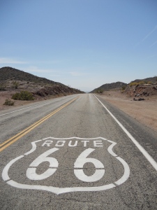
It’s great to be back in San Francisco, after a 3-week vacation – where I flew to Chicago, and then drove all the way back to California via Historic Route 66. When I was a child growing up in Chicago, I learned of the great “Mother Road” that takes you from Grant Park to the Santa Monica Pier – and it was my dream to drive all of its 2,448 miles. It’s the road that Okies took during the Great Depression to find jobs in California, and in the 1950’s and 60’s it came to symbolize America’s move west to the Sunbelt. And the fact Route 66 no longer exists (the U.S. Highway System had the road de-commissioned in 1985, because the Interstate made it obsolete) made this trip feel like a real adventure. I blogged every day, and learned a lot of things along the way – some profound, some of them just plain obvious. Here are my Top Ten insights from driving Route 66, as we leave Chicago for Los Angeles.

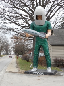
Gemini Giant - Wilmington, IL

(1) Illinois Does the Best Job Promoting Route 66: Before going on this trip, I spent a lot of time studying Route 66 – cross-referencing books and online guides with Google Maps to follow it as faithfully as possible. But in Illinois, that work was largely unnecessary – as the Land of Lincoln does a great job promoting Route 66. Every town milks its connection to the Mother Road in the most ridiculous way – from the Gemini Giant in Wilmington, to the old two-room jailhouse in Gardner.

South of Springfield, it gets tricky – as there are two possible alignments. Take the one further west, as it follows a stretch of original 1920’s roadside brick – a charming part of Route 66 that I dubbed the “Red Brick Road.” Driving it was surreal.

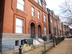
(2) St. Louis Reminded Me of New Orleans: For better and for worse, Saint Louis has a lot in common with New Orleans – an historic 18th Century city with French influence, that has fallen on hard times. All the guidebooks told me to avoid driving in much of St. Louis, but I ignored it – and witnessed the worst inner-city poverty I have ever seen. I was lucky to stay in the Soulard, a charming red-brick neighborhood south of Downtown with cobblestone streets. The word soulard is French for “drunk,” and each year Soulard throws the biggest Mardi Gras celebration outside of New Orleans.

The Soulard in St. Louis

(3) Missouri’s Poverty Was Overwhelming: I had never been to Missouri, but the state’s poverty as you drive through the Ozarks was truly depressing. Trailer homes line all of Route 66, with churches like Assembly of God & Seventh Day Adventists – along with the occasional cheap porno magazine shops. There were few of the touristy Route 66 stops we saw in Illinois (except for the World’s Largest Rocking Chair, just west of Cuba.) When I stopped for lunch in Springfield, I mentioned to the waiter how struck I was at the level of poverty in Missouri. “We got all kinds,” he replied to me. “We’ve got the trash and the filthy rich.” But I never saw the filthy rich.

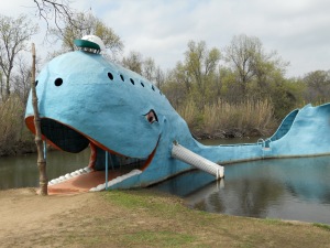
The Blue Whale in Catoosa, OK

(4) What’s the Matter With Oklahoma? In 2004, journalist Tom Frank wrote his bestseller What’s the Matter with Kansas? – but the question should really be asked about Oklahoma. It is the only state where Barack Obama failed to win a single county, and of course in 2010 Republicans swept every statewide office. But Oklahoma’s favorite son is political humorist Will Rogers – and locals call Route 66 the Will Rogers Highway. I visited the Will Rogers Museum in Claremore, and bought a CD of his 1930’s radio broadcasts. The guy was a hard-core economic lefty, and he had some choice words about what the white man did to Native Americans. My only guess of what went wrong is the prevalence of “pro-life” religious billboards along Route 66.

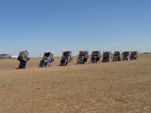
Cadillac Ranch - just west of Amarillo, TX

(5) Wind Energy from the Texas Panhandle: When speaking of alternative energy, Van Jones says we have a “Saudi Arabia of wind energy” in Middle America. Nowhere is that more true than the Texas Panhandle, which has hundreds of miles of flat countryside – and the harshest wind I’ve ever seen. It’s ironic that Texas, which prides itself on vast oil fields and a “drill, baby, drill” mentality, actually could help relieve our dependence on fossil fuels and lead us into the 21st Century.

(6) Amarillo Has a Good Gay Scene: Here’s a pop quiz: which city has more gay bars? Amarillo – a city of 200,000 in the very, very Republican Texas Panhandle, or Albuquerque – a city of 500,000 in the “leaning blue” state of New Mexico? The answer, surprisingly, is Amarillo – with its vibrant venues like Sassy’s (which has karaoke every Friday night until 12!) My theory is that if you’re gay in the Texas Panhandle, there is really nowhere to go but Amarillo. But gay singles don’t really mingle in Albuquerque. New Mexico is where middle-aged same-sex couples settle down and look at the stars.

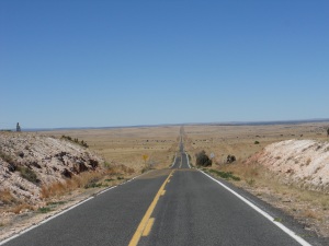
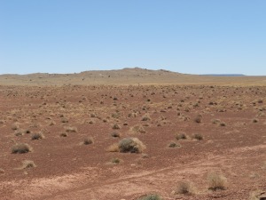
The road south of Cuervo, NM

(7) There are 2 Types of Cowboy Hats: Okay, this one’s a bit obvious – but it was news for a city boy like me from San Francisco. As anyone who saw my photos on Facebook, I morphed into quite a cowboy on this trip – and learned that every cowboy has at least two hats: a dark felt hat to keep them warm in the cool months, and a white straw hat to keep cool during the summer. And according to the clerk at Cavender’s in Amarillo (where I bought my Stetson), you shouldn’t wear your straw hat until Easter.

(8) New Mexicans Are Sweet, Laid Back and Friendly: Besides being the most beautiful state on Route 66, the Land of Enchantment truly has what other parts of the country call Southern Hospitality. Everything closes on Sundays – but when the waiter in Las Vegas, New Mexico heard that I wanted a bolo tie, he called the local jeweler at home and asked him to open up his shop so I could buy one. In Santa Fe, the parking lot attendant let me stay there for free – if I promised I’d leave before 10:00 p.m. And the bartender gave me a free coffee rather than use my debit card, because I’ve been driving across the country. That’s what New Mexico culture is about.

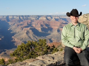
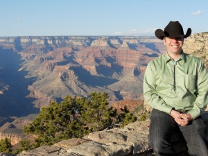
Me at the Grand Canyon

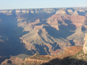
(9) Private Cars Should Be Banned from the Grand Canyon: I did a side trip to the Grand Canyon, which was lovely – but I didn’t have time to hike all the way to the bottom, and the South Rim with its traffic woes felt like a big amusement park (and I wasn’t there during peak season.) There’s been talk of banning private cars from the Grand Canyon, which would mean that most visitors would arrive by train from Williams, Arizona. Which is a brilliant idea. Williams was the last Route 66 town to be by-passed by the Interstate, and the only thing that’s kept it from turning into another McLean, Texas is its proximity to the Grand Canyon. An exclusive gateway for travelers would be a big economic boon to Williams, Arizona.

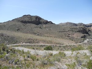
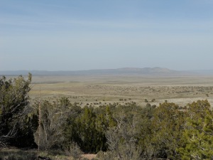
Black Mountains of Western Arizona

(10) Don’t Miss the Black Mountains of Western Arizona: The last 160 miles of Route 66 in Arizona deviate from the Interstate quite a bit – going through towns like Seligman, Kingman and Oatman and a beautiful stretch of open desert. Oatman is cute with its wild burros roaming the streets, but it seems like all 150 of its residents work in the touristy gift shops. The real reason to travel this part of Route 66 is the curvy roads in the Black Mountains. As you maneuver sharp turns at 15 miles/hour, imagine what the Joad family in the Grapes of Wrath went through – with all their belongings in an old clunker. This is the last stretch of road before entering the Promised Land of California, and is by far the most treacherous – but it’s also the most rewarding.

Of course, this Top Ten List didn’t even make it to California – so here’s a bonus insight.
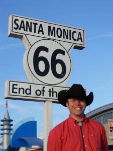
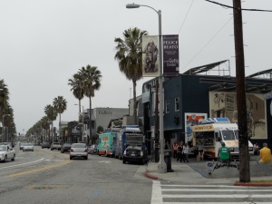
(11) Santa Monica is Cool – But Venice is Cooler: For its last few miles in Los Angeles, Route 66 follows Sunset Boulevard – and then Santa Monica Boulevard all the way to the Pacific Ocean, where it ends at Santa Monica Pier. I’ve always been a fan of Santa Monica, but I spent the next day in Venice – canvassing for Debra Bowen’s campaign for Congress. Venice offers everything that Santa Monica provides – progressive politics, walkable neighborhoods and a nice ocean breeze – but it’s far less gentrified and has more of a hippie vibe. It reminded me a lot of Berkeley (where I lived for eight formative years), so in many ways I felt right at home.

After a couple days in L.A., I drove up to San Francisco – but with Highway One’s road closures due to mudslides this winter, I had to hop onto US-101 for most of the time. It’s a road that most Californians are familiar with, so I’ll refrain from any commentary …
Highway One Day Three: Home at Last

April 22, 2011

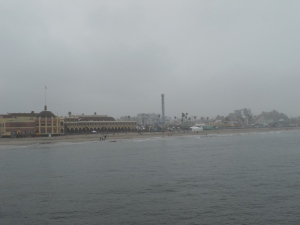
Santa Cruz Boardwalk - on a dreary day

Yesterday was the very last stretch of my amazing 3-week road trip, and I was so exhausted getting home that I’m only now reporting on it tonight. I left Monterey yesterday morning, and headed straight up Highway One towards Santa Cruz. On this stretch of One, it’s a four-lane freeway – as the road borders the artichoke and strawberry fields of Castroville and Watsonville. I’ve got Santana playing in the car to get me in the groove, as I zoom up the road. Pretty soon, the temptation to stop and buy some fresh artichokes is just too much. After all, my dear friend Mary is cooking me dinner tonight – so I really should bring some artichokes as an appetizer for the night.

Arriving in Santa Cruz, the weather is dreary and cold – but I figure it’s just typical California morning fog. Surely, by the afternoon it will be clear skies – as the final stretch of Highway One hugs the ocean on a two-lane trail. So I grab lunch in town and walk a little down the pier, with my Western cowboy gear in full – as I walk in denial that my trip is about to end. A few kids on the Boardwalk say “nice hat” as I walk by, as I really stick out like a sore thumb here.

North of Santa Cruz - along Highway One

But an hour in Santa Cruz doesn’t clear up the skies. In fact, the weather has gotten worse now – and it’s starting to rain. I feel bummed that the final stretch of my trip is going to be in miserable wet weather, and I wonder if it’s a sign that I’m headed back towards reality. Then, I think about it more – and realize that it’s the first real rain I’ve had on my trip for three weeks. So I consider myself lucky, as I head up north towards San Francisco.

As the car zooms through the two-lane road with the windshield wipers swiping, I realize that I need to play something psychedelic and meditative. So I pop in Pink Floyd’s “Dark Side of the Moon.” Of course, the only reason I own that CD is because of the famous urban legend that playing it while watching The Wizard of Oz will reveal some eerie synchronized moments. And yes, I’m as much of a Wizard of Oz dork that I’ve tried it. And while it generally was a huge waste of time, I can’t help thinking of the movie as I listen to the album – because that’s how I first heard all the songs. Meanwhile, the rain splattering along Highway One with Pink Floyd makes it a real trippy existence.

As I get closer to Pescadero, the clouds start to drift away – and by the time I get to Half Moon Bay, it is a beautiful clear afternoon with blue skies. With San Francisco less than an hour away, now is time to take out Pink Floyd – and put in something more upbeat. How about a little Harry Belafonte to get into the groove, as “Shake Shake Shake Senora” gets me through the rocky and windy cliffs near Pacifica.

Near Pescadero, as the skies clear up

Now, I am almost in San Francisco – and at the end of my journey, where I must go back to work the next day. Ever since Los Angeles, I’ve been dreading this part of the trip. But you don’t really dread going home if you are happy, and if your life is good coming back home is something to look forward to.

I don’t fully appreciate that, however, until I turn off Highway One just south of San Francisco and switch to Skyline Boulevard – so I can come into town on the Great Highway. The road goes up a hill, and I see the Sunset, Richmond, Golden Gate Park, the Presidio straight ahead – with the Golden Gate Bridge just peaking on top in the distance.

At that point, the emotions get the better of me – and I turn off the CD player. It’s time for me to open my mouth, and belt out a song for the occasion. Join me and Jeannette McDonald, as we sing along (with lyrics below):

It only takes a tiny corner of,
this great big world to make the place you love,
My home upon a hill, I find I love you still,
I’ve been away but now I’m back … to … tell … you

San Francisco! Open your Golden Gate!
You let no stranger wait, outside your door!
San Francisco! Here is your wandering one,
Saying I’ll wander no more.

Other places only make me love you best!
Tell me you’re the heart of all the Golden West!
San Francisco! Welcome me home again!
I’m coming home, to go roaming no more!

I just can’t help it. I sing the song three times over, as the car climbs up the Great Highway towards Golden Gate Park. I suddenly choke up, and realize why I love living here like I do, and why it has been my home for so many years now. I may have had a good childhood in Chicago, but I really came into myself here in San Francisco. I put down roots in the Bay Area, and I’ve learned to thrive and be a happy and developed person out here.

I think about the Birthday Party I had with friends before I left town, and that I already have a friend tonight who’s making me dinner. I think about all the opportunities I have awaiting me here, in this fair City by the Bay. I’m not sad my vacation is over. Because as Dorothy told Auntie Em: “there is no place like home.”

I’ll have some final thoughts on my 3-week road trip in a few days …

Highway One Day Two: Finding the Promised Land

April 20, 2011

Somewhere near Cambria

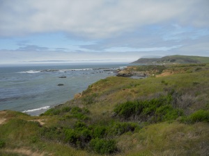
Today was the second of my 3-day drive up from Los Angeles to San Francisco – and with Highway One’s various road closures, it proved to be the one where I spent most of my time on US-101. But I’m not disappointed, because the scenery I saw still reminded me why California has been the Promised Land for so many generations of Americans – and why I have chosen to live here for the rest of my life. While I’m in denial that my vacation ends tomorrow, I have a newfound excitement and appreciation for heading back home.

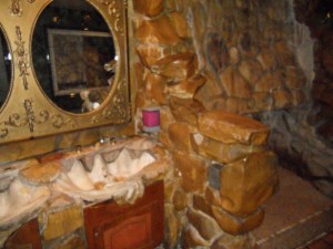
The famous Men's Room at the Madonna Inn

My morning in San Luis Obispo started simple enough, with my friends on Facebook telling me I have to check out the Madonna Inn for breakfast – and that I should show up in my Western attire. The manager of the Hostel Obispo concurred with their opinion, so I took off. I was not disappointed … Breakfast was only so-so, but the ambience was pretty incredible – and you can see how a group of local Hollywood ranchers would come hang out here. Photos of the owner with John Wayne adorned the area, and as everyone kept raving about the Men’s Room – I just had to go take a look. It was a trip and a half. But what I thought was best were all the banquet rooms, which clearly made me feel this would be an excellent place to have a wedding!

Morro Bay

Leaving Madonna Inn, it was 10:00 a.m. – and I had a reservation at Hearst Castle to do a tour at 12:00 noon. Knowing that much of Highway One was closed and I would not have much time to drive up in the afternoon, I headed due west towards the Ocean – hoping to catch some of the incredible scenery in the morning. And to get into the mood, I snapped the Beautiful Thing soundtrack as the soaring vocal harmonies of Mama Cass and the Mamas & the Papas got me into that California Dreamin’.

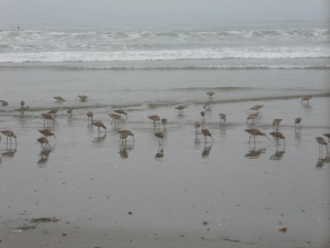
Sadly, the morning fog hue still sank over the coastline – leaving a gray residue for what could be a more glorious view. Still, I stepped out of the car in Morro Bay – to watch these adorable “sand-piper” birds on the beach, as they sucked their prey through their long beaks. As the tide rolled in, the birds all jumped back and forth as if on cue. It was really fun to watch. Further north near Cambria, the fog started to lift – and I took some pretty amazing pictures (which can be viewed on my Facebook page), but I didn’t have much time. My reservation at Hearst Castle was coming up soon.

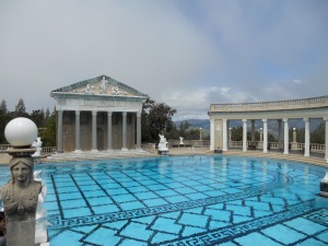
Hearst Castle

Of course, Hearst Castles was as grandiose and opulent as I had expected it to be. The billionaire news publisher William Randolph Hearst spent over 30 years with architect Julia Morgan designing his palatial estate, and he technically “never completed” it because he kept on changing his mind about how to expand and build it even more. That being said, the Main House still had 115 rooms upon his death – and doubtless would have had more if he had lived even longer.

The son of a mining entrepreneur who had raised his family in luxury, William Randolph Hearst was a compulsive art collector at an early age – and the Castle is a real treasure trove of European medieval architects, complete with modern renditions of ancient architecture that fit Hearst’s eccentric style. Hearst spent much of the 1930’s and 40’s expanding this estate, which reminded me that back then the very rich still paid a huge percentage of their income in taxes. Did Hearst pay his fair share to keep our country going, or – like General Electric today – did he manage to find loopholes to cheat himself out of the system?

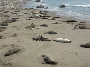
With the tour over by 2:00 p.m., I still wanted to drive up Highway One further – but knew that with road closures there would only be so much I could see. Moreover, it was still a very cloudy and foggy day – which meant the views would be far less spectacular than otherwise. But that being said, there was one place along Highway One north of Hearst Castle that I very much wanted to see – the Elephant seals.

Elephant Seals

Elephant seals congregate along the beach here in California, after they spend months traveling throughout the Pacific Ocean. After months of solitude at sea, they are a playful and social bunch on land – and it was a pleasure to watch. I noticed quite a few of the seals rub each other on the neck – as if they were “necking” each other romantically. Of course, it could also have been two males thumping their chests in a kind of macho, “domineering” way. But a thought crossed my mind as I watched them. Could it be that, at least in the case of a few of them, it was both? Why do we presume all animal couples to be heterosexual – if homosexuality is a phenomenon among humans? Could it be that I saw a few gay elephant seal out there today?

Satisfied with my brief excursion up north, it was time to head south and exit Highway One at Route 46 – so I could make my way to US-101. One lesson I’ve learned from this trip is that it’s a hell of a lot better to take Highway One southbound than northbound – because you’re on the side of the road facing the Ocean. If you’re driving north, the temptation to look over your shoulder and turn left on the curb is all too tempting – and far more dangerous. I briefly enjoy the southbound trip on Highway One, as I go back to rejoin Route 46.

Route 46

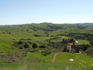
Heading off Highway One, I prepare to play some Creedence Clearwater Revival in the car – as I expect the guttural voices of wannabe hicks from El Cerrito to keep me focused on an unappealing scenery. But wait … Route 46 isn’t so bad. Wow, it’s actually quite beautiful. Sure, we’re not on the Ocean – but it’s a lot less cloudy, and the hills are a gorgeous green that I haven’t seen in a very long time. CCR can wait till later on the trip – now is time to play something more idyllic, something more joyful, something more … Californian. So I pop in the California Golden Overtones, Berkeley’s female a cappella group as I marvel at the rolling green hills of northern San Luis Obispo County.

The Golden Overtones take me the 20 miles to re-gain US-101 – as I head due north on the freeway. Sure, I’m going at 70-80 miles per hour on a dreaded Interstate – but the scenery is quite amazing down here. This is so much more pleasant than driving on I-5, and any Californian who can’t take Highway One for some reason should really take US-101 if they can. Approaching King City, the scenery gets more drab – but now I’ve got Creedence Clearwater Revival to keep me company, as the car zooms all the way up to Monterey for the night.

I’m now spending the night close to Monterey with my old college friend Maria, and her boyfriend. She takes me out to have drinks in Carmel at a fabulous seaside restaurant owned by Clint Eastwood, and we then have dinner at a great Indian place in town. Tomorrow, I head back to San Francisco for the very final leg of my vacation. It has been one truly memorable and exciting road trip!

Highway One Day 1: The Road to San Luis Obispo

April 19, 2011

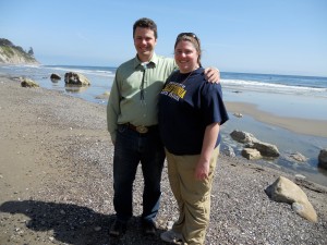
Me and Melissa, in Santa Barbara

With my Route 66 trip over, I am now making my way back to San Francisco. And because I’m in denial that my vacation is about to end, I’m taking my sweet little time to get home – over three days, by way of California Highway One on the Pacific Coast. Today, I took the leg from Los Angeles to San Luis Obispo – which wasn’t hard, because much of the One for this stretch of road is actually merged with US-101.

Unlike Route 66, this is a road trip I’ve taken before – and as a Californian, I’ll have the chance to do it again. But I’m doing it because I want to associate good memories with this route. I took it once before in 2004: when I left Berkeley, my asshole roommates handed me a letter asking me to move out – ironic, given I was on the Berkeley Rent Board at the time. I resolved to not let it ruin my vacation, but it certainly distracted me while I tried having a good time. Now, I have the chance to do it again – and link the beauty of Highway One with better times in my life.

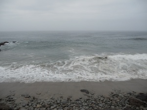
Ventura County Line

I left Redondo Beach this morning, as Jim and Sandra helped put the last items back in my car. As I headed through L.A. traffic to take Pacific Coast Highway due north, I put in an Eric Clapton CD to maneuver the challenging landscape. Pretty soon, Los Angeles gave way to the ritzy neighborhoods of Malibu – where you have to pay just to park on the beach and take in the beautiful scenery. Screw that, I’m going to keep driving until I can park somewhere for free. With the Eric Clapton CD done, I put in some George Harrison – the last album the ex-Beatle produced before he died, and was released posthumously.

By now, I’m in Ventura County – and can park the car and step out on the ocean. The sky is overcast, but it’s still a beautiful day – as I sit meditatively on the rocks while the Ocean creeps up on the beach. I’m the only one here, and it feels lovely – still a million miles from where I need to be, as far as I’m concerned. I look on the map, and see that Oxnard is the next town. But wow, Santa Barbara isn’t that much farther away – where I’m supposed to meet up with Melissa, an old friend from law school. I call Melissa, and tell her I’ll be there in an hour.

Santa Barbara

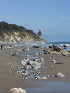
The drive from Oxnard to Santa Barbara is really easy, because Highway One merges with US-101 – a freeway. By now, I’ve switched from George Harrison to the “Moulin Rouge” soundtrack – and I get to Santa Barbara in time. Melissa is getting her PhD in History, and lives in graduate student housing. It’s lunchtime, so we get in her car to go eat at a fabulous beach-house restaurant in town. Melissa tells me it’s her favorite beach in Santa Barbara, and we take our leisurely time after lunch to explore the birds and cliffs on the waterfront. Now, the clouds have parted and the sky is a gorgeous hue of blue. She drives me back to where I parked my car – and now it’s 4:30 p.m. I had spent over three hours in Santa Barbara!

Getting back on US-101 due north, the ocean hugs the freeway – and it’s a glorious sight to see. But of course, I can’t stop the car and take pictures – because everyone’s racing at 70 miles per hour. So I put in my Beach Boys album to get into the groove, as the first song “Surfin’ USA” calls out all these cities I’m familiar with like Santa Cruz, Pacific Palisades, Manhattan Beach, Redondo Beach, Ventura County Line and La Jolla. Except for La Jolla (which is in San Diego), I already have – or soon will – pass by each of these communities as I drive back up to San Francisco.

Much to my chagrin, Highway One deviates from the Ocean after a few miles – but the drive inland is lovely, with lush green hills that tell me “wow, this is California.” You can see why Americans across the country have migrated here, to come to the promised land. But I still yearn to be back on the beach – sometime before the day is done.

Pismo Beach

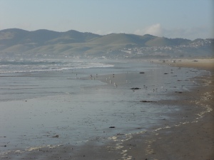
After an hour of maneuvering through hills (with Led Zeppelin to keep me company), I finally get my wish in Pismo Beach. By now, it’s almost 6:00 p.m. – and the sun is beginning to set. But I don’t have much more driving to do today – so I take a slow walk into the beach, teasing the waves as they slowly come crashing in.

A mere 20 minutes later, I’ve arrived in San Luis Obispo – a good mid-point for Highway One travelers who take the journey from L.A. to San Francisco. I’m staying at the Hostel Obispo – where I stayed nearly 7 years ago, which is one of the better youth hostels that I’ve visited. Tomorrow, I will go visit Hearst Castle which is a few miles north – and try to see what part of Highway One’s majestic glory I can check out. Unfortunately, it’s been a really bad winter – and mudslides have closed large sections of the One this year. I won’t be going to Big Sur sadly, but I hope to check out as much as I can – before visiting another old friend of mine in Monterey tomorrow night.

Walking through the Ocean Breeze in Venice, L.A.!

April 18, 2011

Dante Atkins, myself, Laura Van + Shayera Tangri at the Formosa Cafe in West Hollywood.

Today was my one day of respite in Los Angeles, before proceeding with the final leg of my road trip along Highway One back home! And what does a political dork like me do for my one day of vacation, while in town? Go canvass for Debra Bowen’s campaign!! I spent a lovely few hours in Venice with my netroots friends, doing what we believe in!

The 36th Congressional District – which includes Venice in West L.A., as well as the South Bay suburbs of Torrance, Redondo Beach, Manhattan Beach, etc. – is having a special election on May 17th, because incumbent Jane Harman has resigned. And one of my favorite state politicians – Debra Bowen – is running in what has become a very crowded race. Debra is the California Secretary of State (and prior to that, was in the state legislature) and has long been a champion of open and transparent government – as well as the progressive issues we all care about. Her main competition, Janice Hahn, is an L.A. City Councilwoman – and pundits expect it to be a race between the two.

But there’s a third candidate – Marcy Winograd, who twice ran against Harman to protest her stand in favor of the Iraq War. I personally supported Marcy when she ran both times – but during those runs she also proved incapable of expanding her appeal beyond hard-core left-wing activists. With Harman gone, we now have an opportunity with Debra Bowen to get a winning progressive for this largely suburban district – and Winograd is merely a spoiler in the race. In fact, there’s hard evidence that Janice Hahn baited Winograd into the race this time as a cynical strategy to split progressives.

Venice, California

I met at the home of Venice netroots activist Marta Evry this morning (along with Dante Atkins of Daily Kos, and Laura Van) – all friends I have gotten to know through my work in the liberal blogosphere. Venice is the most progressive part of the district (where Wingorad did best in her runs against Harman), and our task was to get voters to support Debra Bowen. And it was a lovely day to be outside – with the breeze from the Pacific Ocean caressing us as we walked the streets and knocked on doors. Venice reminded me a lot of Berkeley, as a lefty community with educated voters who are interested in having political conversations at the door. Having lived in Berkeley for many years, it really felt like home.

Most voters were very supportive, and quite a few were aware of the race. One voter told me they had voted for Debra Bowen in her prior races, and would surely vote for her again. It’s always hard when you’re having these conversations to gauge how effective you’re really being, but the impact that a volunteer has coming to your door is really quite huge. Sometimes, it’s hard to appreciate that until you see the election results.

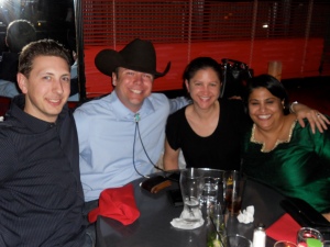
So did I wear my cowboy gear while canvassing for Debra Bowen? No, this is Venice – after all. When you’re knocking on doors for a political candidate, it’s important to stay “on message” and look the part. While I didn’t show up in flip-flops and a surfer t-shirt, I just went as myself. But the netroots crew insisted they wanted to see me in my Western garb – so I promised that when we go out to dinner, I would have my boots and cowboy hat on! Four of us had a lovely dinner in West Hollywood at the Formosa Cafe – although sad to say, we didn’t have any movie celebrity sightings!

I also extended my rental car reservation today for an extra three days – so that I can drop it off in San Francisco on Wednesday. I’ve been driving a black Jeep Compass on this trip, which came in really handy when I drove on some unpaved parts of Route 66. Tomorrow, I head up north – as I plan to get home on Wednesday. Of course, parts of Highway One are still washed out because of mudslides – so I’ll have to play it by ear as to how much of the Scenic Road I can take. But never mind for now … I have a reservation to go visit Hearst Castle!

Route 66 Day Thirteen: The Ocean at Last!

April 17, 2011

Santa Monica: the End of Route 66

Yes, I really was as giddy as I looked in the photo this afternoon – when I arrived at Santa Monica, California: the terminus of Route 66. After driving 2,448 miles from Chicago to L.A., it has truly been a wonderful and memorable experience – one I will remember for the rest of my life. I wouldn’t necessarily do it again, but it’s one of these trips everyone should do once – and I am eternally grateful that I was able to go. I’ve enjoyed having all the friends and loved ones following my adventures, asking me questions, giving me advice and encouragement along the way. Tonight, I’m staying in Redondo Beach with my old college friend Jim and his fiancée, Sandra. And I leave Monday for San Francisco to go up Highway One!

Last night in Victorville was fun, as I discovered Ricky’s – the one and only gay bar in the whole High Desert Region. This morning before leaving town, I went to the car wash. I’m supposed to return the car tomorrow at LAX, and pick up another one to take to San Francisco. I’m hoping I will impress them that I took such good care of the Jeep Compass all the way from Chicago, that they’ll let me take it back home!

Now I’m ready to finish the final leg of Route 66. I hop onto I-15, heading due south towards San Bernardino. As the San Gabriel Mountains stared right in front of me, I popped in a Jimi Hendrix CD – as the “purple haze” of psychedelia compared with the purple haze of the mountains.

Route 66, thru the San Bernardino National Forest

But I’m not on the Interstate for long. As soon as we reach the mountains, I exit onto El Cajon Boulevard – where Route 66 cuts through the San Bernardino National Forest, zigzagging the valleys between each mountain with the Interstate only a few feet above. The Route 66 books said this would be the last “rural” part of the drive, as I step into a calm and serene environment before hitting the Greater Los Angeles Metro area. At one point, I even discover a new town – Devore Heights, which prides itself on its pastoral presence with horseback riding lessons aplenty. But I don’t really have time for that right now. After all, I did that back in Arizona.

My first stop in San Bernardino is to visit the first McDonald’s restaurant. It’s almost 12:00, so maybe a good time to grab lunch. As I drive towards it, I fantasize about ordering my food at the counter – but instead singing that UC Men’s Octet classic, “McDonald’s Girl” which has lyrics that go: I’ll have an order of fries, a quarter pounder with cheese, I love the look in your eyes, will you go out with me please? I am in love with a McDonald’s Girl – she is an angel in a polyester uniform. Of course, I’ve never had the guts to do that when I go to McDonald’s. Maybe I’ll do it at this one!

The First McDonalds in San Bernardino

It’s all a moot point – because when I get to the first McDonald’s, it’s not a restaurant. Just a museum. Now some of you may be reading this, and wonder: “wait a moment. The first McDonald’s was not in California; it was in Des Plaines, Illinois – just outside of Chicago.” My brother-in-law grew up in Des Plaines, and I’m sure he’s muttering this right now.

Well, here’s the whole story. McDonald’s was first founded by two brothers named Richard and Maurice McDonald, who opened up a San Bernardino restaurant in 1937. Ray Kroc was so impressed by what they had to offer, that he convinced them to let him open his franchise of restaurants named McDonalds – which he did in 1955, the first one being in Des Plaines.

In 1961, Kroc bought out the brothers for $2.7 million – but was unaware the deal did not include the original McDonald’s in San Bernardino. Furious, Kroc vowed never to talk to the McDonald brothers again – and also to never give them credit for this international phenomenon. That’s why we hear a lot about Ray Kroc today (who “founded” McDonald’s), but we rarely hear about the McDonald brothers.

Donut Man, in Glendora

So I didn’t have lunch yet, but that’s okay. I got to head due west on Route 66, and make a stop in Glendora at Donut Man. My friend Jim gave me the address, and told me I absolutely had to stop there and order their strawberry donuts. West of San Bernardino, Route 66 follows Foothill Boulevard – as we zoom through the suburbs of Rialto, Fontana, Rancho Cucamonga, Claremont, San Dimas, etc. I’ve got Sheryl Crow in the car playing, which gets me into the mood that I’m heading towards L.A. – with the giant car washes that line the road. Sure, I could be taking the Interstate – which would mean no red lights. But traffic is going smoothly, as I maintain a decent 40 mph speed – traveling from suburb to suburb. After an hour, I stop in Glendora to pick up some donuts. Nowhere really to have lunch here, so I keep heading west.

Now it’s 2:30 p.m., as I drive into Pasadena. Still haven’t had lunch yet, but I don’t care. Traffic has been going smoothly, and I’ve got the Sheryl Crow CD on repeat in my car. I’ve already played “all I wanna do is have some fun, before the sun comes up over Santa Monica Boulevard” twice now, and loving every minute of it. My friend Dave Dayen, who blogs at Firedoglake and lives near Santa Monica, has texted me – and says he’d be free to meet me at 4:30 p.m. Surely, I could finish this road trip in two hours. I’m not even hungry … as I am simply giddy with excitement that my Route 66 road trip is almost over.

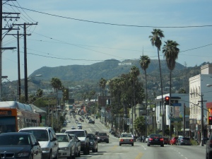
Sunset Boulevard, with Hollywood Hills

Route 66 follows the Pasadena Freeway into town, as I get my first brief taste of L.A. traffic. But I exit the Freeway just past Dodgers Stadium, and onto Sunset Boulevard. I’m now so excited, that I don’t have music on anymore. I just admire my surroundings, as the car heads downhill – and I get a beautiful view of the Hollywood Hills with the famous Hollywood landmark sign in the distance.

Route 66 follows Sunset Boulevard, until we hit Santa Monica Boulevard – which it will follow all the way until we hit the Pacific Ocean. I get a giddy sense of excitement, as I head due west on Santa Monica Boulevard – and I just can’t help myself. Whenever the car is stopped at a red light, I update my Facebook status on my phone to announce where I am. First, West Hollywood. Then, Beverly Hills. And finally, Santa Monica. Of course, I’m mindful of staying focused on the road. Would be terrible to get into a car accident – when the road trip is almost over.

Santa Monica Pier

The last 10 blocks in Santa Monica are an unmitigated traffic jam – as cars crawl (if at all) towards the ocean. Are the Gods playing a trick on me, with my road trip almost over? No, it’s just a beautiful day – and everyone is going to the beach. Holy Shit, it’s 4:30 p.m. already – I’m going to be late. So I call Dave, and leave a voice-mail. He calls me back, when I’m at 2nd Street & Santa Monica Boulevard – and I just found a garage to (FINALLY!) get out of my car. He suggests we meet at a bar, and I tell him to text me the location. I tell him that first, I must go to the end of Route 66 to signify my terminus. It’s there that the photo featured at the top of this blog post was taken. I was so giddy to finally have arrived!

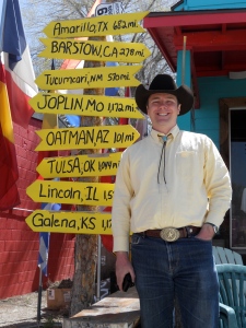
Of course, Dave had suggested a bar at Lincoln & Grant – which is not exactly walking distance from where I am. But dammit, I just parked my car after going through the worst traffic nightmare of my life. I am *NOT* driving there, so I walk – not realizing that we’re talking almost two miles. And I’m walking in my cowboy boots, my cowboy hat, my bolo tie – and it’s 85 degrees. And I’m wearing a bright red shirt. I trod along the streets of Santa Monica in my Western garb, as amused onlookers take pictures of me as I race down the street. When I finally arrive to meet Dave, the bar’s jukebox is – co-incidentally – playing Johnny Cash. We sit down, and have a couple beers.

Santa Monica Pier

Dave is going to a barbecue later, and I want to check out Santa Monica Pier before sundown – so he gives me a ride back towards the general area. As I walk out onto the Pier, I have this giddy sense of excitement that I’ve arrived after a long journey. I’m not shy to tell strangers that I’ve just driven the entirety of Route 66 all the way from Chicago, and many offer to take my picture in front of landmarks. Near the end of the Pier, I come across the “last gift-shop” on Route 66. It’s a very touristy souvenir store, but they have a “blow-out” sale of jackets for $35 – with a sewed badge that says: “Santa Monica: Route 66 – the End of 2,448 miles.” Well, why not? I think I deserve it … so I buy the jacket and put it on, as I watch the sun set over the Pacific Ocean.

Words cannot describe how exhilirated I feel about having completed Route 66 – the Mother Road. Over at my Facebook page, my friend Ronda writes: “I’m glad you had fun, but I’m sorry it’s over, I enjoyed reading your saga.” Not to worry, my vacation adventures are not over. Tomorrow, I spend the day in Los Angeles – where I will walk precincts for Debra Bowen, an amazing candidate for Congress running in a special election. And on Monday, I head back north to my home in San Francisco. My plan is to do Highway One along the Pacific Coast, but I’m not sure yet how much of that will be doable. There were terrible mudslides in Big Sur, and some of the road is still inaccessible. But not to worry … I’ll see how much of the great Scenic Highway I can still do before going home!
Route 66 Day Twelve: The Last Stretch of Desert

April 16, 2011

Route 66, as the National Trail Highway between Needles & Barstow, CA

Today was another scenic day on Route 66 – as I traversed the whole Mojave Desert from Kingman, Arizona to Victorville, California. I’m blogging from the Green Tree Inn in Victorville – and the San Gabriel Mountains (which separate us from Los Angeles) are in spitting distance. Tomorrow will be my final stretch of Route 66, as it winds from San Bernardino to the Santa Monica Pier in busy L.A. traffic. Today was a significant milestone for my road trip – as it marked the last rough terrain of the journey.

I left Kingman this morning, after catching breakfast at Beale Street Brews. It was a nice cafe, but all things considered I was still unimpressed with Kingman. All through Kingman, everyone told me to not miss Oatman while I’m on my way to California. It’s a fun town, they all said, where the “burros run the place.” So I get in my car, and head southwest on Route 66 towards Oatman.

I had read that the trek on Route 66 between Kingman and Needles is the most treacherous part of the journey, as you maneuver sharp turns through the Black Mountain Range. So I knew I couldn’t have upbeat music with catchy lyrics that would get me distracted.

The Black Mountain Range, with Route 66 swirling in all directions.

But still, I wanted to play something that would match the mood of the scenery – something grand, majestic and powerful. After fiddling through my CD’s, I finally find the perfect score for the occasion: Carmina Burana.

The Black Mountain Range is nothing short of spectacular, and I encourage you to view all the pictures I took over at my Facebook page. As the road made sharp turns throughout the mountains and I skillfully steered my car at 15 to 20 miles per hour, it made me realize how difficult it would have been for the Joad family in the Grapes of Wrath – as they maneuvered their old clunker (with all their possessions) through the same mountains. After all, this is the final stretch of Route 66 before you hit California – the Promised Land for these Okie farmers – and it must have been both physically and emotionally exhausted.

But I stay focused on the road, as the choir sings about horny drunk monks and their perverted sisters, whose virginity made them frisky (i.e., yeah, that’s basically a rough translation from Latin of what Carmina Burana is about.) All the while, I stop the car at every occasion to take photos – as the drive is really incredible.

Oatman, AZ - where burros run free

Suddenly, about a mile before I get into Oatman, three wild burros are just standing in the middle of the road. I take out my camera and snap a few shots, but they’re not afraid. It was a preview of what was to come in town.

Oatman, Arizona was a trip and a half. The old mining town only has about 150 residents, but the main drag is full of tourist shops – as wild burros walk nonchalantly down the street. It kind of reminded me of “Northern Exposure,” where the moose walks down the streets of Cicely, Alaska at the start of each episode – but Cicely was fiction, and Oatman is real. I get out to stretch my legs, and pet the burros. Oatman is also famous for where Clark Gable & Carole Lombard spent their honeymoon (after getting married in Kingman), because they enjoyed the solitude of a small mining town. But while Oatman is fun, it’s really become a tourist trap. Everyone is here for the same reason as me, and they all love the burros. I talk to a couple gift shop owners, and it becomes clear to me very quickly – nobody really lives in Oatman. So while it’s a fun place, you’re not really seeing any locals.

As I leave Oatman and head west towards California, the road straightens out – but the mountains are still majestic. We’re not far from Joshua Tree – so why not? I take out Carmina Burana, and pop in U2’s “Joshua Tree” album – as I belt out the lyrics while speeding down Route 66. As I cross the border, a guard asks me if I have any fresh fruit or plants, and I say “no” – so they let me move on. It’s a little past 12:00 pm now, so a good time to stop for lunch in the first town past the border – Needles, California.

Needles, CA

As I drive into Needles, my first reaction is “HOLY SHIT! Gas is expensive!” By crossing into California, it went from $3.69 per gallon to $4.69 – a whole dollar. Gas was over $4 back in Chicago, but because I picked up my rental car with a full tank – I didn’t have to fill up until Pontiac, Illinois. This was the first time on my trip where I’ve had to pay more than $4/gallon.

Needles turned out to be a good pit stop for my trip. I found a cute burger joint for lunch, a Bank of America to get some cash, a gas station to get gouged (although the car had really good mileage after going 20 mph in the Black Mountains) and a tire store for them to check my tire pressure. “They’re a bit worn,” noted the guy – after I told him I’d been driving since Chicago. But he checked them all, and gave them a clean bill of health – so I proceed into the Mojave Desert.

Old National Trail Highway

For this part of California, Route 66 follows the Old National Trail Highway – as I zoom through the Mojave Desert, going almost as quickly as I’d be going on the Interstate. This is real dry desert, as I sing along with Bono to two U2 albums. I’ve planned to spend the night in Barstow, because it’s one of the songs in Bobby Troup’s Get Your Kicks On Route 66 song. But I’m making really good time, and will probably be there around 4:30 p.m. Do I really want to spend my Friday night in Barstow? All I know about Barstow is they got a cowboy bar called Gingers, but I seriously doubt that it’s a gay cowboy bar.

As Route 66 follows the Interstate a few miles away, I get a little tired of U2. Now, this may be fighting words for some – but I’ve always preferred R.E.M. over U2. So while driving through the Mojave Desert, I flip in R.E.M.’s “Automatic for the People” album – as my vocal range more closely resembles Michael Stipe, rather than Bono’s.

Ludlow, CA

By the time I get to Ludlow, I am debating between spending the night in Barstow – or driving a little further down to Victorville. The clerk in the coffee shop tells me to go Victorville, because there’s “more to do.” It’s also home of the California Route 66 Museum, so I decide – unless Barstow really moves me, I’m spending the night in Victorville.

West of Ludlow, Route 66 gets extremely rough and rugged – and I’m grateful to be driving a Jeep Compass. I can only go at about 30 miles per hour on this terrain, and I put some Billie Holliday in the CD player, just for a little change of venue. Taking Route 66 when you’re practically driving next to the Interstate is pretty cool, but not when the road is so rugged that you’re just crawling at a slow pace. But that’s unfortunately the way it is for the next several miles, until I hit Newberry Springs. At this point, Barstow isn’t much further away – and I’m able to regain a decent speed. By now, the Billie Holliday CD is done – so I pop in some Cesária Évora for the rest of the trip.

My initial take on Barstow is a good one, as there are plenty of cheap chain motels to choose from. But it’s still early, so I move on. Then, I get into Downtown Barstow – and don’t even stop the car. It’s depressing here, so I confirm that I’ll spend the night in Victorville. Driving out of Barstow, the road goes through some beautiful countryside (and a few kitschy Route 66 stops that are sadly closed at 5:00 p.m.), as I finally drive into Victorville.

At my hotel in Victorville

As Route 66 follows D Street and then 7th Street into Downtown Victorville, I’m about ready to cry. There are no decent hotels around, and the area is chock-full of pawn shops and boarded-up buildings. It’s depressing, and I seriously think about just driving all the way to Los Angeles for the night. But my cell phone battery is about to die, and there’d be no way for me to call Jim – and let him know I’m arriving a day early. So with frustration building up inside me, I trod through Victorville – in search of a decent place for the night. Right before Route 66 hits the I-15, I see a sign for the Green Tree Inn. It looks like a busy place, as there is some type of old-car “convention” going on in its front garage. But as I arrive at the hotel front desk, they do have vacancies for the night – and the clerk offers me a sweet deal. I have a great room to stay in tonight, before I head off for Los Angeles in the morning …
Route 66 Day Eleven: The Open Road in Western Arizona

April 15, 2011

Seligman, AZ: When this trip is over, I will have been to all these towns.

I love the Internet, and specifically Facebook. As I woke up this morning before leaving the Grand Canyon, my cousin Emily had commented on my FB status – suggesting that, if I’m not too lake, go to the El Tovar Hotel for breakfast and order their pancakes. So I did …
Now, a word on the various accommodations in the Grand Canyon. I stayed at Yavapai Lodge, which was one of the less expensive hotels, and had its own cafeteria. When I arrived on Tuesday, I figured it would be the cheaper food option – and I paid way too much for my spaghetti & meatballs. So last night, I ate at the Bright Angel Lodge Restaurant – and my far superior dinner turned out to be about the same price. The El Tovar Hotel is *the* fanciest place to stay in the Grand Canyon, and its restaurant is quite pretentious. But because all I had was pancakes and coffee, it wasn’t too expensive. In other words, cafeterias are a rip-off!

Williams, AZ

Leaving the Grand Canyon, I headed south on Route 64 towards Williams – in order to re-join Route 66. And because I wanted to sing Joe-Joe left his home in Tucson Arizona, for some California grass, I popped in the Beatles’ “Let it Be” album in the CD player. One hour later, I arrive in Williams to get some gas … and get a cup of coffee in town.

Williams, Arizona is famous on Route 66 for being the very last town to be by-passed by the Interstate. After a long legal battle, Williams eventually lost in 1984 – and thus Route 66 was de-commissioned by the U.S. Highway System. But unlike McLean, Texas (which was really depressing), I found Williams to be a thriving town with a cute historical downtown – despite the locals telling me they took a hit.

My guess, however, is that Williams is also the only way to get to the Grand Canyon by train, with a nice depot in the heart of the city. If the National Park Service bans all private cars in the Grand Canyon (which would be an awesome idea, frankly), it would be a huge boon to the economy in Williams. If I hadn’t stayed in the Grand Canyon itself, I could have totally spent the night here.

Ash Fork, AZ

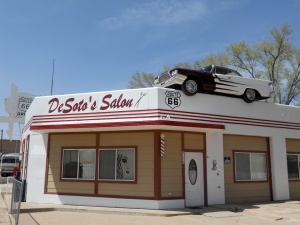
Getting back on the Interstate, I exit a few miles west in Ash Fork. But besides the car on top of a building, Ash Fork looks like another one of those depressing Route 66 towns that never recovered from the Interstate – so I move on.

As I mentioned the other day, more than any other state Arizona requires Route 66 travelers to stay on the Interstate. But once I exit about 16 miles east of Seligman, this is no longer true. The last 160 miles of Arizona will be completely on Old Route 66, as I am giddy with anticipation to hit the open road.

Old Route 66 fails to disappoint, as I zoom down the desert prairie without a car in sight. This would be the perfect time to put in my Bruce Springsteen CD and do “Born to Run,” but I played that already – back in the Texas Panhandle. And besides, I’m on a Beatles fix now.

So after “Let it Be” I put it in “Abbey Road” – singing (or harmonizing) to every song on the album. Later on, I put in “Rubber Soul” – as I sing Baby you can drive my car to absolutely no one in particular. This may not be the red rock desert of Eastern Arizona, but the mountains here are spectacular – and the miles of sagebrush tell me I’m all alone.

Roadkill Cafe in Seligman, AZ

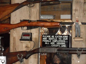
Arriving in Seligman, the town has milked its Route 66 connection to a ridiculous extent. Tacky souvenir shops are everywhere – and when a gift shop owner tells me about the Roadkill Cafe, I know I just can’t resist grabbing my lunch there. At the Roadkill Cafe, which sports signs like “unattended children will be sold as slaves” or “sex prohibited on premises – but a little messin’ around is ok,” I order their famous Buffalo Burgers. Call me naive, but they say it’s made of real buffalo meat. Of course, the old gag every time a customer at Roadkill Cafe asks for the menu is – “mean you didn’t bring it in?” I could have stayed in Seligman longer, but I’m eager to cover more miles today – as I head on Old Route 66 towards Kingman.

I’d like to make good time to Kingman (since I don’t have a hotel reservation yet), but I have plenty of time to spare – and my hunch is Kingman’s not a popular place for the night. A few miles west of Seligman, I see a huge sign for Grand Canyon Caverns – a Route 66 “must-see.” I had seen Grand Canyon Caverns on the map before, but had not been clear what it is exactly. Turns out it’s another cave. Now, I’ve just been to the Grand Canyon – and I went to Meramec Caverns back in Missouri. So what does Grand Canyon Caverns have to offer? “It’s the oldest dry cavern in the world,” says the clerk – as he explains that Meramec was a “wet cavern.” But I’m not very impressed – and don’t want to spend 45 minutes in a cave.

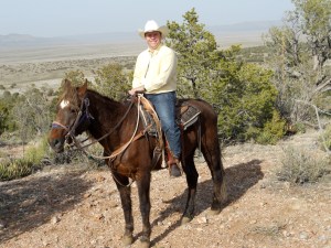
Riding a horse at Grand Canyon Caverns

But right next to the Cavern entrance is a stable where you can sign up for horseback riding. I’ve got time to kill, and it’s a beautiful afternoon in Western Arizona – so why not spend the next hour riding a horse? I sign up for it, and Jimmy the tour guide finds me a good horse to get on – as we roam the 800-acre ranch. I’m truly embarrassed that I forgot my horse’s name, but he did have one – so it’s not like I’ve been to the desert on a horse with no name. What I do recall is that my horse was 22 years old (which is ancient for horses), and he was very very slow – but that was okay by me.

While riding a horse at Grand Canyon Caverns

Jimmy regaled me with stories about growing up out here in Arizona, and his children and grandchildren. It is truly a labor of love for him. As we ride for an hour, the desert scenery is beautiful – as we spot the occasional jackrabbit galloping between the bushes. There are beautiful cactus plants here as well, and I feel that I’m truly a million miles from everything. When the ride is over, I tell Jimmy how much fun I’ve had – and how this was so much better than I’d ever imagine going down to another underground cavern would have been. “I still haven’t gone,” he says nonchalantly. “It’s 22 feet below the ground, and Hell is at 23 feet. What if the elevator forgets to stop?”

I leave Grand Canyon Caverns – as I zoom the car down Old Route 66 through the small towns of Peach Springs, Truxton and Valentine. Not much to really stop for in these places, but I’ve got the mountains and desert scenery all around – and the Fab Four from Liverpool are still in my car, as I sing along loudly to songs like “Nowhere Man” and “In My Life.”

Hackberry, AZ

As I get close to Kingman, the terrain gets rougher – which tells me it’s time to switch to some more mellow music. So I stop the car at the General Store in Hackberry (which is full of cute Route 66 souvenirs), and I put in some Don McLean for the last 25 miles. The first two songs are soft and mellow, as I maneuver tough hills and a windy road – but almost as if on cue, the road straightens out nicely just in time for “American Pie.” I then spend the next 8 minute and 33 seconds, zooming down Route 66 singing along to my favorite song of all time – with the mountain range on my right, and a train rolling by on my left. Then, as if by sheer luck, the song concludes as I get my first red light in Kingman. I slow down the car, as the other Don McLean songs mellow out – and I get closer to Downtown Kingman.

I had not made reservations in Kingman, but had heard of the Hotel Brunswick – a rustic and historic landmark that seemed like a perfect place to spend the night. But when I get there, the block is a little sketchy – and a man steps out of a bar next door, and informs me that the Hotel went out of business. I ask him about other options nearby, and he suggests the Motel 6 a few blocks away. I check into Motel 6 for the night.

Kingman, AZ

After getting my room, I take a short walk into downtown – as the sun sets. Frankly, the little I’ve seen of Kingman so far does not impress me. It certainly milks its Route 66 connection, but the local museum is closed. So I head back towards Motel 6, where I grab dinner at a neighboring restaurant – Calico. I have a pleasant meal, sitting at the counter – and chatting with the waitress, who’s originally from Massachusetts. She suggests that before I leave tomorrow, go downtown and get a cup of coffee at Beale Street Brews. “Tell them Joanne sent you,” she says.

An Amazing Day in the Grand Canyon!

April 14, 2011

Me and my mule Sassy

Today, for the first time in over 10 days, was not about driving a car for hours from town to town. It was about riding a mule … and walking through the Grand Canyon, to explore one of the Seven Wonders of the World. I took 176 pictures (and yes, you can see them all on my Facebook page), and I could easily have taken more. But every time I was done, I just couldn’t help it and had to snap a few more.

I got up this morning, and only had one thing on my schedule – my mule ride at 12:30 p.m. Now granted, this was not one of those famous Grand Canyon Mule Rides – where you ride a mule all the way down to the bottom of the canyon, spend the night and come back the next day. Those rides are out of my price range, and require at least a 12-month reservation. No, I took the 3-hour ride – where we ride a mule through a forest, get to the Abyss Overlook of the Canyon and then ride back. And that was just fine by me!

South Rim - from Bright Angel Lodge

I arrived at Bright Angel Lodge this morning, with a little over two hours to kill before my mule ride. So I decided to walk along the South Rim of the Canyon – going west from the Lodge (yesterday, I went east.) At daytime, the sky was so much bluer – which added a whole new dynamic to the Canyon. Pretty soon, I found the Bright Angel trail – which goes all the way down to the bottom of canyon. I knew I wasn’t going to have time to go very far down, but opted to see how far I can get down – and what the perspective looks like a few hundred feet below.

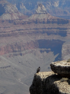
The Condor bird - viewed from Bright Angel Trail

As I headed down the trial, I started kicking myself about not having chosen to do the Mule Ride in the morning. If I’d done that, it would have freed up more time for me this afternoon – and explored the Canyon further down. But there was nothing I could do about it now, so the best I could do is take in the scenery.

On a nearby ledge, I saw a beautiful black Condor bird. The Condor is native to California, and was threatened with exctinction. But thanks to help from preservationists, it has been brought to the Grand Canyon – where they are a thriving and majestic creature. I sat down on the trail, and waited for the Condor to spread its wings (which spans up to nine feet) and fly. But the condor just stood there on the ledge, as its audience continued to grow. Animals at the Grand Canyon are used to the attention, and they are totally non-chalant of what’s around them. It’s really quite wonderful. The condor probably didn’t feel her audience was big enough!

Abyss Overlook on the South Rim. Notice the Colorado River in the middle.

At 12:30 p.m, I’m back at the Mule stables to get on my ride. It’s been 20 years since I’ve ridden a horse/donkey/mule, but I’m reasonably confident that it won’t be a problem. The first mule doesn’t react to me very well, so they give me another mule – a female named Sassy. Mules are used in the Grand Canyon, because they have twice the life expectancy of horses – and twice the stamina!

We all line up, and walk in a single file through a beautiful and serene forest – as we head towards the western edge of the South Rim. Arriving at the Abyss Overlook, I can finally spot the Colorado River – the only place on the South Rim where it’s visible. While I didn’t ride a mule down to the bottom of the Canyon, this is a part of the South Rim that would have taken me a long time to walk across – so it was a real treat to be there. If I’d had more time at the Grand Canyon, I could have made it there myself. But because I’m leaving tomorrow, this was perfect.

The Mule Ride ends at 4:00 p.m., and I’m eager to get back on the Bright Angel Trail – and see how much further the Canyon I can go down. But it’s getting awfully windy, and it’s much colder than it was yesterday. I realize that I won’t have the option to walk down the Canyon, so I explore the South Rim further west.

A word on my fear of heights. For my whole life, I’ve been afraid – but it’s been my determination in recent years to overcome that fear. The Grand Canyon was incredible, but it’s important to keep your eyes focused on what lies ahead. Once you start looking straight down and see how far up you get, your legs start to tremble. I got into that habit this afternoon (really testing myself, in a way), so the rest of my walk on the South Rim was less pleasant.

But this trip was just to get an initial taste of the Grand Canyon. I’m leaving tomorrow to continue my Route 66 trip, but I have every intention of coming back here soon. The beauty is nothing short of remarkable …

Route 66 Day Ten: A Day in Red Arizona!

April 13, 2011

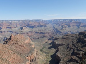
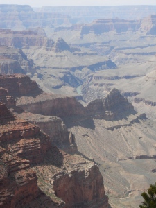
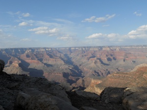
South Rim of the Grand Canyon

I’m blogging to you live from the Yavapai Lodge in the Grand Canyon, on my second attempt. I tried to blog right after dinner, but the wi-fi connection was so AGONIZINGLY slow that I gave up. After taking a nice walk through the woods, I came back around 10:30 p.m., and found the wi-fi was faster now – making it the perfect time to reflect on what has been another incredible day. I’ve been driving for 10 days now, but tomorrow will be my reprieve – as I spend the whole day exploring the Grand Canyon!!

As I reported last night, I slept in a wigwam last night – at the Wigwam Motel in Holbrook, Arizona. It was both awesome and ridiculous at the same time – and you can see pictures of what my room looked like over at my Facebook page. But this morning, I tried to take a hot shower – which didn’t work, until the hotel management figured out that the “hot” and “cold” knobs were backwards. Having taken my hot shower for the morning (and a delicious breakfast down the street), I am ready to leave Holbrook – heading due west towards Winslow, Arizona. And of course, there’s only one CD to put into the stereo for this drive: the Best of the Eagles!

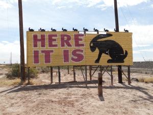
More than any other state, Arizona requires Route 66 travelers to spend most of their time on the Interstate. Between towns, it is open red desert country – and the roads are inaccessible. So I reluctantly get onto the Interstate as the Eagles sing about a “Peaceful, Easy Feeling” and the gorgeous Arizona scenery gets me into the mood. Pretty soon, I exit at the Geronimo trading post – because the sign on the Interstate claimed the “world’s largest petrified tree.” Frankly, I was not impressed – but the clerk at the gift shop told me that most of the tree is buried underneath the ground. But not as picturesque as I hoped it would be. A few miles down the road, I once again exit to visit the famous Route 66 landmark – the Jackrabbit Trading Post with it’s “Here it is” sign. Not much there, however, except a gift shop with more curios to sell to gullible tourists.

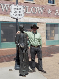
Standing on the Corner in Winslow, Arizona

By 11:00 a.m., I finally arrive in Winslow, Arizona. And the town has milked its fame to the Eagles song to a ridiculous extent. At the corner of 2nd & Kinsley, I come across the “Standing On the Corner” park – complete with a life-size statue for a quick photo opportunity – while the gift shop across the street plays “Take it Easy” in a loop over and over again. I asked the clerks if they ever get sick of the song. No, they insist, “or else we wouldn’t be working here.” Fair enough … Downtown Winslow is actually a cute town with great old architecture, so I grab a cup of coffee while snapping more photos.

The battery on my digital camera is running low (and the rechargeable feature has mixed results), which is making me nervous as I head to the Grand Canyon. So I ask locals in Winslow if they can recommend where to buy a new battery. They all suggest Wal-Mart – so even though I had sworn not to step into Wal-Mart on this trip, I found the one in Winslow. The good news, however, is that Wal-Mart didn’t have the one I was looking for – so I left without buying a thing. The Wal-Mart clerk was very nice, though, and suggested I go to Best Buy in Flagstaff.

Getting back on the Interstate, I get more and more wistful about taking side roads. And with the yellow New Mexico sagebrush having been replaced by the red rocks of Arizona, it’s frustrating that Route 66 won’t let me take the frontage roads. But with 40-odd miles to go before getting to Flagstaff, I notice an exit for Meteor Crater – the “first proven, best-preserved meteorite crater on earth,” and the crater where every astronaut who went to the Moon got their training. Why had I never heard about this place?

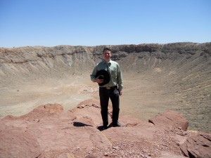
Meteor Crater is about 6 miles south of the Interstate, so the open road allows me get a small taste of the Arizona desert – just enough to satisfy my urge. And I’m really glad I went. When you arrive, a friendly tour guide takes you on a 45-minute trip around what is basically a huge hole in the ground. 50,000 years ago, a meteor hit this part of the world – and what’s incredible is that nobody really noticed until sometime in the late 19th Century.

Meteor Crater - between Winslow & Flagstaff, Arizona

Of course, the white settlers who discovered it were interested in exploiting it for mineral resources – and they spent about 30 years fruitlessly looking for fragments. What happened, in fact, is that the meteor pretty much disintegrated upon impact – leaving very little beneath it. But today, it’s a popular tourist attraction – and has been critical at helping scientists understand the impact of meteors and craters. Check it out, if you’re in that part of the world.

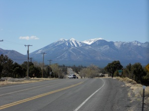
By the time I leave Meteor Crater, it’s 2:00 p.m. – and I’m hoping to get to the Grand Canyon fairly soon. So I get back onto the Interstate, as the majestic, snow-capped mountains get closer and closer. The Eagles are now singing “Take it to the Limit,” which gets me into the mood as the mountains stand right there in front of me.

Somewhere near Winona, AZ

Before Flagstaff, though, I see an exit on the Interstate for Winona. And of course, Bobby Troup’s song Get Your Kicks on Route 66 reminded us to “not forget Winona.” Frankly, I didn’t see what was so memorable about Winona – the town itself was so small, that I drove right by it. But what was special was the road itself – as the mountains of Flagstaff got closer. Because I am no longer on the Interstate, I can actually stop the car and take a photo – which I did right here. The road winds towards Flagstaff, as the Eagles sing “Hotel California” – which could not be more perfect given the scenery.

In Flagstaff, I go to Best Buy and get a new battery for my digital camera – as I leave Route 66 to go due north towards the Grand Canyon on Route 180. Flagstaff had some snow a few days ago (a local told me it was the “last hurrah” of the winter season), and we still have some snow on the ground – but it won’t last. North of Flagstaff, gorgeous Ponderosa pine trees line the road as I get into the mood about hitting the Grand Canyon.

I get to the park at 5:00 p.m. – just in time to check in for my mule ride tomorrow, and then catch the sun set on the South Rim at 7:00 p.m. By 6:00, I am strolling along the South Rim with my Western attire – as the gorgeous canyon speaks to me in the most mythical way. A small boy, who must be about 6 years old, approaches me and asks: “are you a cowboy?” I look at him, and say: “no, I’m just having too much fun on this vacation.” I think it’s important that we don’t lie to small children. It only confuses them, when they get older and realize the truth for themselves.

Right when you think you’ve taken the perfect Grand Canyon picture, you get another view of the South Rim – and you can’t help it. As a result, I took many many photos today – all of which can be seen on my Facebook page. I walk two miles from Bright Angel Lodge to Yavapai Lodge, as the sun slowly sets and the red of the canyon reflects back. At one point, I spot an elk on the pathway – completely oblivious to the tourists walking by. He doesn’t even run away when I take pictures. Later on, I see a group of deer – who likewise remain nonchalant. It’s beautiful here, and I can’t wait to spend the whole day tomorrow exploring it …